- News Updates
- PSU Watch
- Defence News
- Policy Watch
- हिन्दी न्यूज़
- Jobs Watch
- States News
- Event News
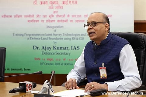
New Delhi: "With over 18 lakh acres estates, DGDE is one among the largest land managing organizations of the government land in the country. Also, this land pool is having varied types. While some chunk includes urban land, other are in remote and some in difficult terrains. So, it is extremely heartening to see that DGDE is adopting modern technologies and it would certainly improve the quality of the land management system," Defence Secretary Dr Ajay Kumar (IAS) said on Monday. He was speaking at the inauguration of a Capacity Building Program at National Remote Sensing Center (NRSC), Hyderabad via video conferencing.
The training programme consists of the latest survey technologies and mapping of defence land boundaries using Remote Sensing and Geographic Information System (GIS) for officers of Indian Defence Estates Services (IDES) and Technical Staff of Directorate General Defence Estates (DGDE) on October 18. The first batch of the training started at National Remote Sensing Center (NRSC), Hyderabad, while the program was inaugurated via video conference from New Delhi.
Inaugurating the programme defence secretary urged the officers to keep themselves abreast with the latest technologies in the Survey of Defence Land. He also emphasized the need to use technology in the Survey of Defence Land. Dr Ajay Kumar (IAS) recalled the successful completion of the digitization of defence land records by DGDE, through which, he said that the requirement from other organizations for public infrastructure projects like road, rail lines and power projects etc., in defence lands could be easily negotiated. He added that it could also ease the process of renewing the Leases. Dr Ajay Kumar pointed out the efforts of DGDE viz., developing surveillance system through satellites, to monitor the changes in the ground so that to take any corrective actions in case of any violations or encroachments.
First batch training is aimed to train the trainees mainly in domains of Introduction to Remote Sensing, Image interpretation, Digital image fundamentals and radiometric enhancement, Geo-referencing of image, Projections & coordinate systems, Introduction to Geographic Information System (GIS), Data Conversion techniques, Error detection, editing and validation of spatial database, Maps composition, Hands-on practical session relevant to above topics.
In the next phase, one-week training for IDES officers to familiarize them with the latest technologies is planned for November 2021. It will be a continuing exercise for IDES officers and staff till DGDE's own training Institute (NIDEM) at Delhi develop its own capabilities to impart such training.
Defence Estates Organisation carried out a comprehensive survey of defence lands during 2011-2015 (Phase I). Now a Phase-II survey to verify, authenticate and reconcile the outcomes of the earlier survey has been undertaken and the same is in the final stages of completion. Until recently, surveys were being conducted through ETS and DGPS. This methodology has been time-consuming and outcomes of such surveys may also become outdated by the time the surveys are concluded.
It has been now decided that the latest technologies of land surveys, as well as the processing of data like satellite imagery, Drone-based surveys and data processing tools, should be adopted for more accurate, authenticate, reliable, robust and time-bound outcomes of the survey. These techniques will also enable monitoring of changes on the ground like encroachment or cultivation of land and better planning. Towards this objective, steps have been taken to carry out the drone-based survey of Mahajan Field Firing Range (Bikaner, Rajasthan) which is under progress. Likewise, a satellite imagery-based survey of the Pokhran field Firing Range is in progress. The third project for a real-time change detection system based on the Tome series Satellite imagery for detection of encroachments is also in progress.
Ajay Kumar Sharma, Director General, Defence Estates, Nivedita Shukla Verma, Additional Secretary, MoD, Rakesh Mittal, Joint Secretary, MoD, Dr Raj Kumar, Director, NRSC and Smt Sharmistha Maitra, Director, MoD were present during the said inauguration.
(PSU Watch– India's Business News centre that places the spotlight on PSUs, Bureaucracy, Defence and Public Policy is now on Google News. Click here to follow. Also, join PSU Watch Channel in your Telegram. You may also follow us on Twitter here and stay updated.)